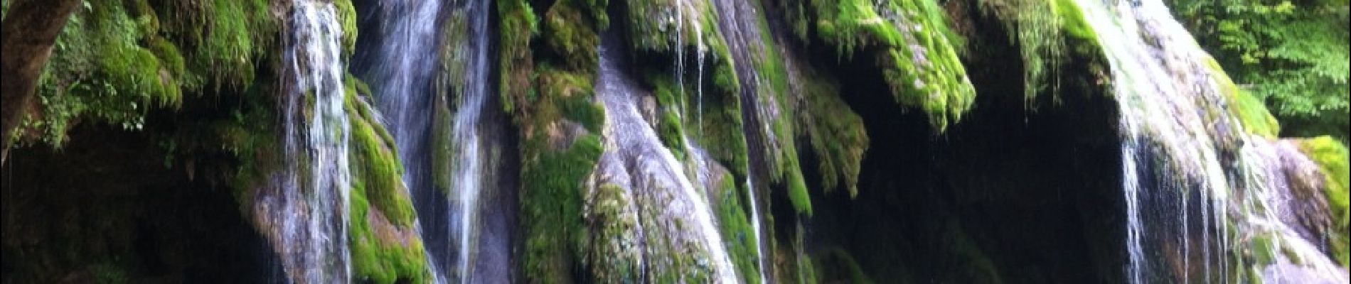
Les Planches d'Arbois

dominiq
Gebruiker

Lengte
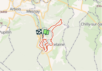
13 km

Max. hoogte
579 m

Positief hoogteverschil
410 m
Km-Effort
18,4 km

Min. hoogte
321 m

Negatief hoogteverschil
407 m
Boucle
Ja
Datum van aanmaak :
2018-06-26 15:04:12.603
Laatste wijziging :
2021-08-21 13:27:32.197
4h55
Moeilijkheid : Medium

Gratisgps-wandelapplicatie
 SityTrail
IGN / Geografische instituten
SityTrail Plus
De wereld gaat voor u open
Over ons
Tocht Stappen van 13 km beschikbaar op Bourgondië-Franche-Comté, Jura, Les Planches-près-Arbois. Deze tocht wordt voorgesteld door dominiq.
Foto's

Plaatsbepaling
Land:
France
Regio :
Bourgondië-Franche-Comté
Departement/Provincie :
Jura
Gemeente :
Les Planches-près-Arbois
Locatie:
Unknown
Vertrek:(Dec)
Vertrek:(UTM)
713766 ; 5195527 (31T) N.
Opmerkingen